Today, it is all about data.
With the recent and ongoing effects of typhoon Odette (local name) that hit the central and southern Philippines, now more than ever, the importance of having reliable and accurate information is highlighted. For Filipinos and its government to be resilient towards natural hazards, a central database or platform indicating hazards and risk of certain areas or regions would be of great help.
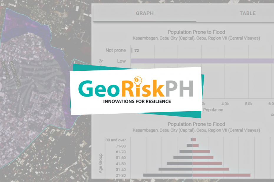
This is the vision of GeoRisk Philippines, a multi-agency initiative led by the Philippine Institute of Volcanology and Seismology (PHIVOLCS), funded by the Department of Science and Technology (DOST) and monitored by the Philippine Council for Industry, Energy, and Emerging Technology Research and Development (PCIEERD).
Various government agencies are the core of this project. PHIVOLCS provides data and detailed information to seismic and volcanic hazards, PAGASA for storm surge and severe wind hazards, and DENR for flood and rain-induced landslide hazards.
Several applications using geospatial information can be used for by Filipinos in the platform. As of writing, the ones available are the following as indicated in its website https://www.georisk.gov.ph/
HazardHunterPH
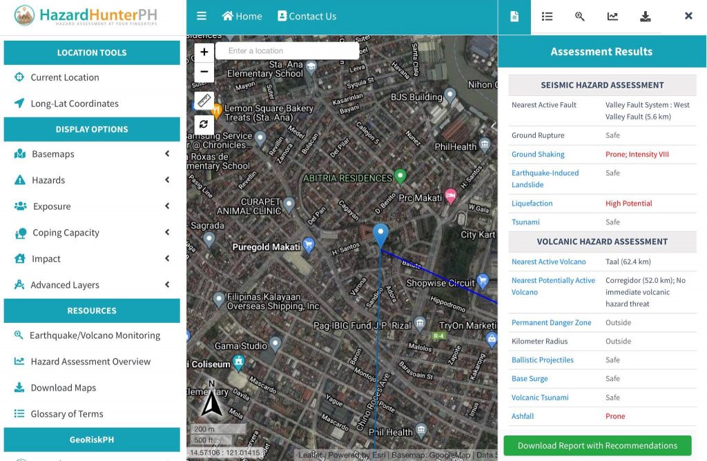
Here, one is able to generate quickly initial hazard assessments based on your chosen location for seismic, volcanic, and hydro-meteorological hazards. It brands itself as ‘Hazard Assessment at Your Fingertips,’ which is exactly just that.
As seen on the screenshot below [as viewed in an iPad device], you are given various display options to choose from and be able to generate a report, including explanation and recommendations in PDF format.
GeoAnalyticsPH
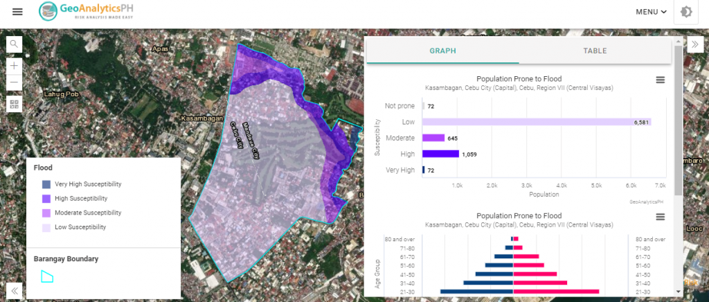
GeoAnalyticsPH is “a web application that can help generate maps and analytics using hazards, exposure, and location data from the GeoRiskPH database.” Assessments can be visualized through maps, charts, and graphs to give a better understanding of the data which leads to early preparation for natural hazards.
Part of this platform is Land Area Hazard Assessment, Population Hazard Assessment, and Critical Facilities Hazard Assessment.
Once in its homepage, you can go to the Single Hazard Analysis where you are to key in your location to be able to generate a report on a chosen hazard just like below.
GeoMapperPH
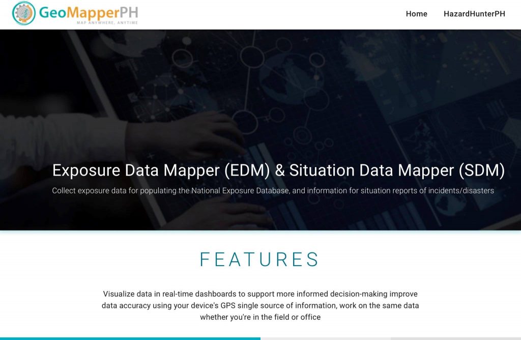
Tagged as Exposure Data Mapper (EDM) & Situation Data Mapper (SDM), this tool is limited only for those authorized to collect exposure data for populating the National Exposure Database and information for situation reports of incidents/disasters, as stated in its website.
Official hazard assessment reports can be requested to DOST-PHIVOLCS, DOST-PAGASA or DENR-MGB for a fee to cover reproduction costs.

Headquartered in the PHIVOLCS office in the University of the Philippines – Diliman in Quezon City, GeoRisk Philippines is every Filipino’s first step towards taking risk- and hazard-related action – one that is based on reliable and accurate information.